
Filter by
The language used throughout the course, in both instruction and assessments.
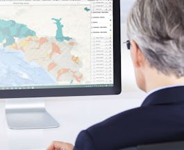
Choose the GIS Course That Aligns Best With Your Educational Goals
University of California, Davis
Skills you'll gain: ArcGIS, Data Analysis, Data Visualization, GIS Software, Spatial Analysis, Spatial Data Analysis, Data Visualization Software, Databases, Geovisualization, Problem Solving, Leadership and Management
University of Toronto
Skills you'll gain: ArcGIS, Data Analysis, Data Visualization, Geovisualization, Spatial Analysis, Spatial Data Analysis, GIS Software, Data Analysis Software, Data Visualization Software, Data Management, Databases, Geostatistics, Statistical Analysis, Mergers & Acquisitions
University of California, Davis
Skills you'll gain: ArcGIS, Data Visualization, GIS Software, Data Visualization Software, Databases, Geovisualization
University of Toronto
Skills you'll gain: GIS Software, ArcGIS, Geovisualization
 Status: Free
École Polytechnique Fédérale de Lausanne
Skills you'll gain: SQL
University of California, Davis
Skills you'll gain: ArcGIS, Leadership and Management
University of Toronto
Skills you'll gain: Data Analysis, Data Visualization, Spatial Analysis, Spatial Data Analysis, Data Analysis Software, Geovisualization, Statistical Analysis, Geostatistics

University of California, Davis
Skills you'll gain: ArcGIS, Spatial Analysis
University of Toronto
Skills you'll gain: ArcGIS, Data Visualization, Geovisualization, Spatial Analysis, Spatial Data Analysis
University of Toronto
Skills you'll gain: ArcGIS, Data Visualization, Geovisualization, Data Analysis, Spatial Analysis, Data Analysis Software, Databases, Spatial Data Analysis, GIS Software, Mergers & Acquisitions

Skills you'll gain: Google Cloud Platform, Network Analysis

University of California, Davis
In summary, here are 10 of our most popular gis courses
- Geographic Information Systems (GIS): University of California, Davis
- GIS, Mapping, and Spatial Analysis: University of Toronto
- Fundamentals of GIS: University of California, Davis
- Introduction to GIS Mapping: University of Toronto
- Geographical Information Systems - Part 1: École Polytechnique Fédérale de Lausanne
- GIS Data Formats, Design and Quality: University of California, Davis
- Spatial Analysis and Satellite Imagery in a GIS: University of Toronto
- GIS Applications Across Industries: University of California, Davis
- GIS, Mapping, and Spatial Analysis Capstone: University of Toronto
- GIS Data Acquisition and Map Design: University of Toronto


